

GodsEye: Earth Intelligence
DownloadApp details
- Version
- 1.0.0
- Updated
- 01.10.2026
- Category
- Navigators and taxis
- Compatibility
- Android
- Package name
com.tiptinker.godseye- Developer
- TipTinker
- Source
- Official Google Play page
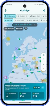
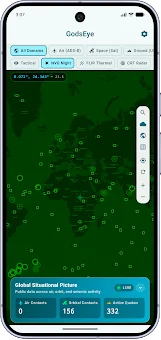
GodsEye: Earth Intelligence is a powerful Android application that unifies public data regarding aviation, orbital objects, and seismic activity into one interactive global map. This instrument allows users to track the movement of aircraft, satellites, and earthquakes in real-time across the entire globe, providing immediate access to detailed information about every tracked object. It serves as a comprehensive tool for monitoring dynamic global events with precision and clarity.
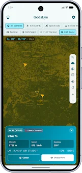
The application offers a range of key features designed for deep data analysis. In the aviation section, you can review reports from flight recorders, gaining access to information such as callsign, flight altitude, speed, and heading. For satellites, the app implements tracking of their positions, calculated using Celestrak elements with the SGP4 model.
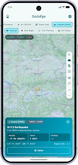
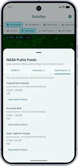
The element catalog is regularly updated to ensure the data remains current and accurate for orbital enthusiasts. In the seismic activity section, the app presents reports from the USGS with details about magnitude, depth, location, and event time. Additionally, the application includes public data feeds covering locations of upcoming space launches, space weather, fire detections, natural warnings, asteroid approaches, SSA weather radar data, and satellite imagery.
How to install the app
- Check the version, Android compatibility, developer and source in the app details block.
- Open the Downloads tab and use the official source or an available catalog link.
- Before installing, review app permissions and use only sources you trust.
Frequently asked questions
What types of data does GodsEye: Earth Intelligence track?
The app tracks aviation data including flight altitude and speed, orbital satellites using SGP4 models, and seismic activity reports from the USGS with magnitude and depth details.
Can I view different sensor modes in the application?
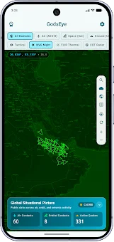
Yes, users can select various viewing modes such as tactical, night vision, thermal imaging, and radar to visualize the tracked objects on the global map effectively.
How is satellite position data calculated and updated?
Satellite positions are calculated using Celestrak elements with the SGP4 model, and the element catalog is regularly updated to ensure the data remains current and accurate.
Is this app suitable for aviation enthusiasts and researchers?
Absolutely, it provides quick access to up-to-date data on air fleet movement, orbital trajectories, and geological activity, making it ideal for enthusiasts and professionals.
Similar apps








No comments yet. Be the first!