
Live World Map: Satellite View
DownloadApp details
- Version
- 15.1.15
- Updated
- 02.11.2026
- Category
- Navigators and taxis
- Compatibility
- Android 10+
- Package name
com.earthmap.livesatellite.worldmap.view- Developer
- SING HAI CORPORATION PTE. LTD.
- Source
- Official Google Play page
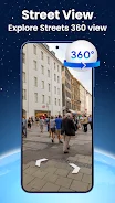
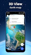
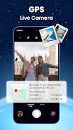
The Live World Map: Satellite View application serves as a powerful instrument for navigation and exploring the planet in real time. This utility combines satellite imagery, 3D modeling of the Earth's surface, and precise GPS tracking to provide users with an immersive geographic experience. Thanks to modern technologies, you can examine cities, countries, landmarks, and natural landscapes using both street-level panoramas and up-to-date satellite images.
It is designed for those who want to see the world from any point without leaving home or who are preparing for a trip and wish to study the route in advance. The main features of the app allow you to fully appreciate its universality. First, you get access to realistic maps of terrain and cityscapes.
You can rotate, zoom, and pan across the interactive map to examine mountains, rivers, buildings, and streets in detail. This is ideal for virtual tours or visualizing locations before a journey. The interface is characterized by clarity and intuitive understandability, making navigation straightforward for users of all skill levels.
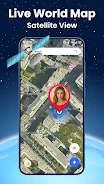
Second, the application provides a satellite view in real time. Images are updated from global GPS sources, ensuring maximum accuracy for monitoring remote locations or studying the natural environment. This feature is particularly useful for tracking changes in geography or observing weather patterns from space.
How to install the app
- Check the version, Android compatibility, developer and source in the app details block.
- Open the Downloads tab and use the official source or an available catalog link.
- Before installing, review app permissions and use only sources you trust.
Frequently asked questions
Does the Live World Map APK offer real-time satellite imagery?
Yes, the application provides satellite views that are updated in real time from global GPS sources, ensuring maximum accuracy for monitoring remote locations.
Can I use the app for offline navigation and route planning?
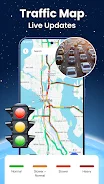
The app includes built-in GPS navigation and a route planner, allowing you to track your position and receive step-by-step directions to avoid delays.
What is the 360-degree panoramic camera feature?
This feature allows you to virtually walk through streets of any city or tourist spot, fully controlling the camera view to create a strong sense of presence.
Similar apps







No comments yet. Be the first!