

OsmAnd+
App details
- Version
- 5.3.10
- Updated
- 31.10.2026
- Category
- Navigators and taxis
- Compatibility
- Android 7.0
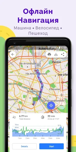
OsmAnd+ transforms your Android device into a powerful offline navigation companion, eliminating the need for constant data connectivity while exploring unfamiliar territories. Unlike traditional GPS apps that demand heavy data usage, this application leverages detailed OpenStreetMap data to provide precise routing directly on your device. Whether you are driving, cycling, or simply walking through a new neighborhood, OsmAnd+ ensures you stay oriented without relying on fluctuating cellular signals.
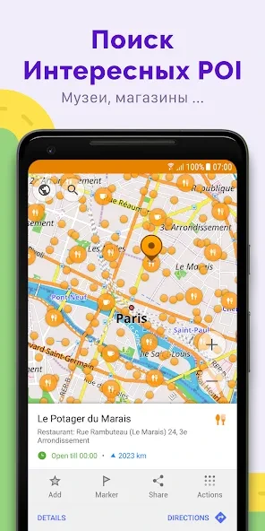
The interface is designed to be intuitive, allowing users to quickly zoom in on specific areas and tap points of interest to calculate optimal paths instantly. This makes it an ideal tool for travelers who want to avoid roaming charges or adventurers venturing into remote areas with limited infrastructure. The app stands out by offering a rich set of features tailored for various modes of transport.
Drivers benefit from clear turn-by-turn directions that remain visible and easy to read even in bright sunlight or low-light conditions. Cyclists can access specialized maps that highlight bike lanes and trails, ensuring a safer and more efficient ride. Pedestrians appreciate the detailed urban maps that show footpaths, parks, and shortcuts through residential blocks.
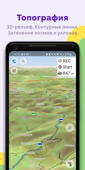
The ability to customize map layers means you can prioritize the information most relevant to your journey, such as elevation profiles, points of interest, or public transport routes.
How to install the app
- Check the version, Android compatibility, developer and source in the app details block.
- Open the official app page on Google Play if a link is available.
- Before installing, review app permissions and use only sources you trust.
Frequently asked questions
Does OsmAnd+ work without an internet connection?
Yes, OsmAnd+ is designed to work fully offline. You can download map tiles for specific regions or countries to your device, allowing you to navigate, search for places, and calculate routes without needing mobile data or Wi-Fi. This makes it ideal for areas with poor connectivity or for avoiding roaming charges while traveling internationally.
What types of maps are available in OsmAnd+?
OsmAnd+ offers a wide variety of map styles including standard road maps, topographic maps, satellite imagery, and specialized themes for hiking, skiing, and cycling. Users can also customize map layers and add overlays to tailor the visual experience to their specific needs, ensuring that the map data is relevant to their mode of transport and activity.
Is OsmAnd+ suitable for outdoor activities like hiking?
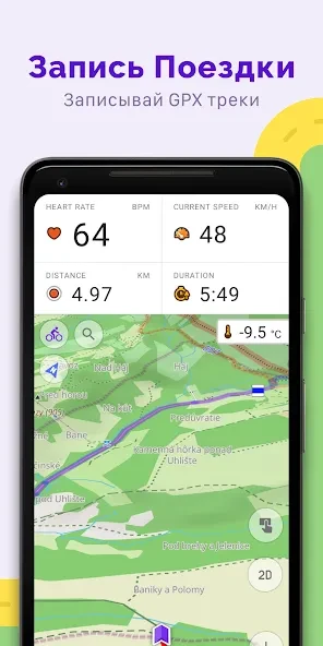
Absolutely. OsmAnd+ is highly regarded for outdoor activities due to its detailed topographic maps and support for GPS tracking. It allows users to record tracks, view elevation profiles, and navigate off-road with precision. The app supports various formats for importing and exporting tracks and waypoints, making it a versatile tool for hikers, cyclists, and adventurers who venture into remote areas.
Similar apps

No comments yet. Be the first!